
Garmin eTrex SE
4.2Editor score
Long battery life
Water-resistant design
Multi-GNSS support
Navigating safely on the water requires reliable tools to track your position and avoid hazards. A dedicated GPS for sailing provides essential data like speed, course, and waypoint management tailored for marine environments.
We evaluated leading models based on durability, battery life, satellite accuracy, and specialized sailing features. This list covers handheld units and larger chartplotters suitable for various vessels and budget needs.
Each pick highlights key strengths and real-world performance to help you choose the right device. Product availability and pricing may change, so verify details before purchasing to ensure you get the best value.
4.2Editor score

4.0Editor score

5.0Editor score
As an Amazon Associate we earn from qualifying purchases.
The following table provides a side-by-side overview of each device to help you compare key specifications and features quickly.



The Garmin GPSMAP 79sc stands out as a top choice for sailors needing a handheld unit with serious marine features. It boasts a rugged design that floats and resists water making it reliable on a wet deck.
We may earn a commission when you buy through this link, at no additional cost to you.
Its preloaded BlueChart g3 coastal charts provide immediate navigation data without extra purchases. The built-in compass and multiple satellite support ensure accurate tracking even in challenging coastal environments where signals might struggle.
While the battery life is solid at around twenty hours it may not last for multi-day expeditions without spare batteries. The price point is also higher than entry-level models but the marine-specific features justify the cost.
Sailors looking for a dependable handheld that combines safety features with navigation accuracy will find this device ideal. It is a strong recommendation for coastal cruising where quick access to charts and buoyancy matter.
The floating design and water resistance offer peace of mind if the unit slips overboard during rough seas.
Preloaded charts save time and money by providing essential coastal data right out of the box.
We may earn a commission when you buy through this link, at no additional cost to you.
The Garmin GPSMAP 65s is engineered for accuracy in difficult environments which can benefit sailors near steep coastlines or dense vegetation. Its multi-band technology ensures a stronger signal lock when standard GPS might fail.
We may earn a commission when you buy through this link, at no additional cost to you.
The large color display makes reading data easy even in bright sunlight. Included topographical maps help when navigating near shorelines or planning land-based excursions during a dock stop.
However this unit focuses more on outdoor hiking than pure marine navigation. Sailors needing deep water charts might prefer a dedicated marine handheld but this is great for versatile navigation needs.
For those who sail near varied terrain or want a robust general-purpose navigator this device delivers excellent performance. It is a reliable tool for adventurers who spend time both on and off the water.
Multi-band support helps maintain a consistent connection even in areas with signal interference.
The sunlight-readable screen ensures you can see your position without squinting or using shade.
We may earn a commission when you buy through this link, at no additional cost to you.
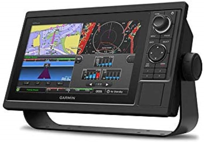
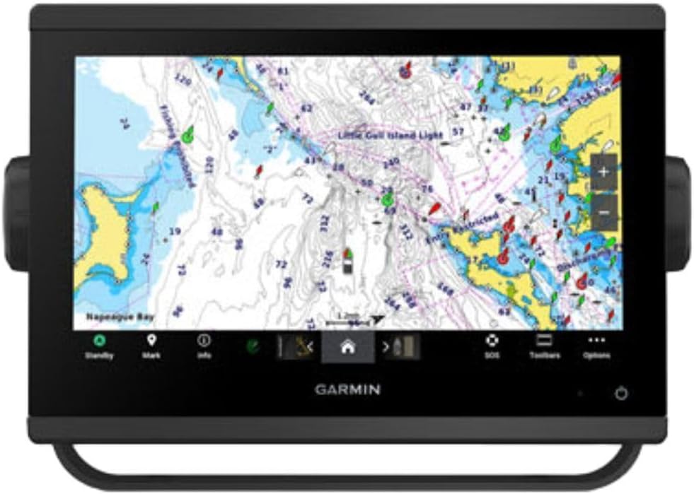
The Garmin GPSMAP 1022 offers a spacious viewing area perfect for detailed navigation on larger vessels. Its high-resolution screen allows for clear chart viewing which is crucial when monitoring multiple data sources.
We may earn a commission when you buy through this link, at no additional cost to you.
With two SD card slots you can expand storage for detailed marine charts and waypoints. The network ports enable easy connection to other marine electronics like radar or autopilot systems.
It comes with a worldwide basemap but detailed coastal charts often require separate purchases. This adds to the overall cost but provides flexibility to customize your navigation setup.
Sailors with a fixed helm station needing a robust chartplotter will appreciate the screen size and connectivity. It serves as a central hub for modern marine navigation systems effectively.
Dual SD card slots allow you to carry maps for different regions without deleting previous data.
Network ports make it easy to link this unit with other onboard instruments for a cohesive dashboard.
We may earn a commission when you buy through this link, at no additional cost to you.
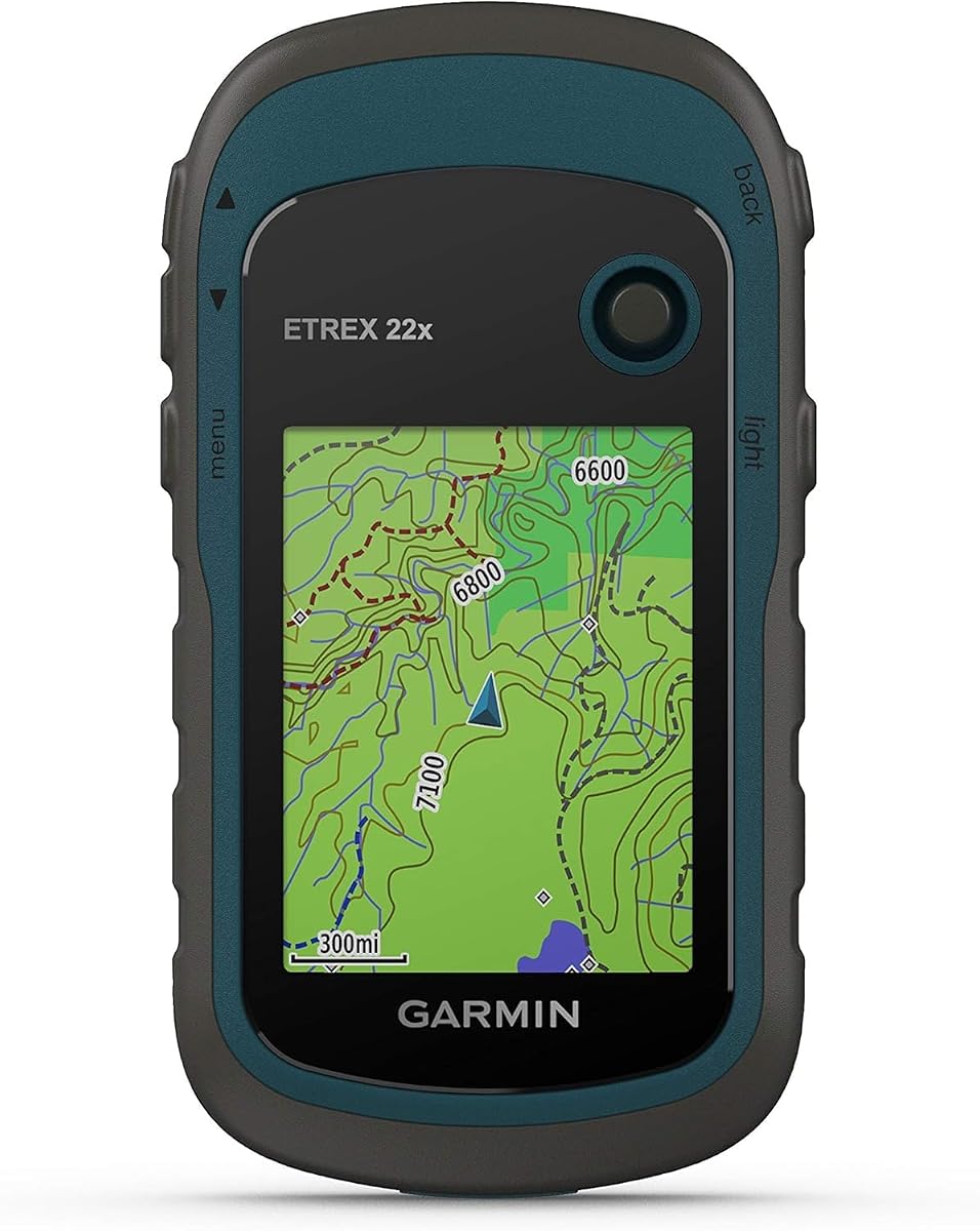
The Garmin eTrex 22x is a tough handheld designed for durability and long outings. Its rugged build can withstand the bumps and drops common on a boat deck or during shore excursions.
We may earn a commission when you buy through this link, at no additional cost to you.
With twenty-five hours of battery life it keeps you powered through extended trips without frequent recharging. The preloaded topo maps help with land navigation if you dock and explore nearby trails.
The screen is relatively small which might make reading fine chart details difficult on the water. It lacks specific marine waterproofing so it should be kept in a dry bag during heavy rain.
For sailors who need a reliable handheld for general tracking and land exploration this unit offers great value. It is a solid backup for position tracking when a dedicated marine GPS is too bulky.
Extended battery life ensures you stay tracked even if your primary electronics fail or drain.
Micro SD card support allows you to add custom maps or additional regional data as needed.
We may earn a commission when you buy through this link, at no additional cost to you.
The Garmin GPS 73 includes specific tools tailored for racing and precise sailing maneuvers. Features like virtual starting lines and tack assist make it a favorite among competitive sailors.
We may earn a commission when you buy through this link, at no additional cost to you.
It offers essential marine alarms including Man Overboard alerts which are vital for safety on small boats. The interface is straightforward with dedicated buttons that are easy to operate while wearing gloves.
This unit is an older model so it lacks some of the modern connectivity and high-res screens of newer devices. It also does not support detailed marine charts out of the box.
If you prioritize race-day functionality and simple reliable navigation this device is an excellent choice. It provides the core tools needed for safe and efficient sailing without unnecessary complexity.
Tools like countdown timers and speed history help crews optimize their start and tack timing.
Built-in alarms ensure you are notified immediately if someone falls overboard or the anchor drags.
We may earn a commission when you buy through this link, at no additional cost to you.
The Garmin GPSMAP 9210 represents the pinnacle of marine navigation technology with its stunning display and speed. It offers a seamless glass helm design that looks modern and integrates beautifully into a boat dashboard.
We may earn a commission when you buy through this link, at no additional cost to you.
Its processing power is significantly faster than older models ensuring smooth chart scrolling and quick data updates. Sailing features like polars and laylines give racers and cruisers precise tactical information.
The price is a significant investment and installation might require professional help due to complex wiring. However the reliability and performance justify the cost for serious sailors upgrading their helm systems.
For those wanting the best in navigation tech this chartplotter delivers unmatched performance and features. It is a premium solution for vessels where accurate and fast data presentation is critical.
The high-definition screen ensures clear visibility of charts and data even in direct sunlight.
Gigabit speeds allow for rapid data transfer and integration with multiple onboard systems.
We may earn a commission when you buy through this link, at no additional cost to you.
The Garmin GPSMAP 79s offers a robust handheld option that balances performance with affordability. It floats and resists water making it a safe companion for active sailing environments.
We may earn a commission when you buy through this link, at no additional cost to you.
Included worldwide basemap helps you track your position anywhere without buying extra maps. The display is clear and easy to read providing reliable tracking via multiple satellite constellations.
While it provides basic navigation it lacks detailed marine charts which might be needed for complex routes. Also the compass works best when standing still so movement can affect heading accuracy.
Sailors seeking a reliable backup GPS or a budget-friendly primary unit will find this model practical. It covers the essentials for safe navigation without the higher cost of chart-loaded versions.
Worldwide basemap ensures you can track your position no matter where you sail.
Rugged construction and water resistance protect the unit from harsh marine conditions.
We may earn a commission when you buy through this link, at no additional cost to you.
The Garmin GPSMAP 943xsv is designed for sailors who want top-notch sonar capabilities alongside navigation. Its ultra high-definition display makes interpreting sonar returns and charts much easier.
We may earn a commission when you buy through this link, at no additional cost to you.
Preloaded mapping provides basic navigation data while the sonar system supports detailed underwater imaging. This combination is ideal for sailors who fish or need to understand seabed topography.
The unit can be expensive and may require specific transducers to unlock full capabilities. It is a specialized device that might be overkill for simple position tracking needs.
For those wanting advanced underwater visualization and navigation in one screen this model is exceptional. It is best suited for vessels where fishing and cruising go hand in hand.
Ultra high-definition scanning provides clear images of underwater structures and targets.
The screen quality ensures data remains legible in various lighting conditions on the water.
We may earn a commission when you buy through this link, at no additional cost to you.
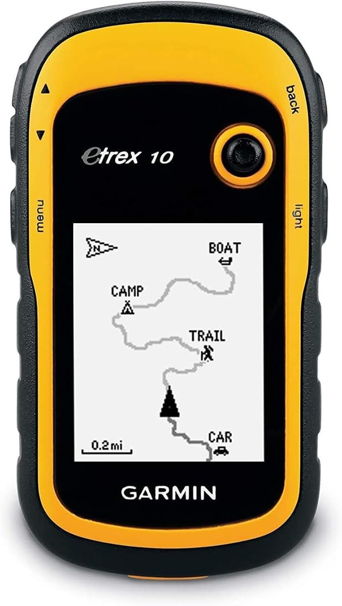
The Garmin eTrex 10 is a straightforward and affordable option for basic navigation needs. It is waterproof to IPX7 standards ensuring it can handle rain and splashes on deck.
We may earn a commission when you buy through this link, at no additional cost to you.
A worldwide basemap helps track your position anywhere without needing extra downloads. The battery lasts about twenty hours which is sufficient for typical day trips or short voyages.
The monochrome display might be harder to read in bright conditions compared to color screens. It also lacks advanced marine features making it better for tracking than detailed charting.
New sailors or those on a tight budget will find this unit offers essential GPS functions reliably. It is a simple tool to ensure you never lose your way during coastal trips.
IPX7 waterproof rating ensures the device survives accidental submersion or heavy rain.
Simple interface makes it easy to learn navigation basics without complex menus.
We may earn a commission when you buy through this link, at no additional cost to you.
The Garmin eTrex SE offers incredible battery life that can last weeks in expedition mode. This makes it an excellent choice for long voyages where recharging is difficult.
We may earn a commission when you buy through this link, at no additional cost to you.
It is water-resistant and includes a digital compass for accurate heading even when stationary. Multi-GNSS support ensures you stay connected to satellite networks wherever you sail.
The display is basic compared to higher-end units but it serves its purpose for tracking. It does not come with marine charts but works well as a reliable position tracker.
Sailors on a budget who need endurance and reliability will appreciate this device highly. It is a smart choice for extended trips where battery power is a major concern.
Extended battery life ensures you stay powered for days without needing to recharge.
Multi-GNSS support provides robust tracking even in challenging satellite environments.
We may earn a commission when you buy through this link, at no additional cost to you.
Selecting the right GPS involves considering your vessel type and specific navigation needs.
Look for devices rated IPX7 or higher to ensure they can survive rain splashes or accidental immersion on deck.
Waterproofing is essential for safety and longevity in harsh marine environments.
A high-resolution display ensures you can read charts and data even in bright sunlight.
Choose screens with anti-glare properties for visibility during day cruises.
Long battery life reduces the worry of running out of power during extended voyages.
Consider models that accept replaceable batteries for easy swapping on long trips.
Devices supporting multiple satellite constellations like GPS and GLONASS offer better accuracy.
This support ensures reliable tracking even in challenging coastal areas with obstructions.
Check if the device supports expandable memory or SD cards for detailed marine maps.
Built-in charts save time but additional storage provides flexibility for different regions.
Look for NMEA ports or Wi-Fi to connect with other marine instruments or smartphones.
Connectivity allows for seamless data sharing across your boat's navigation system.
Features like Man Overboard alerts and buoyancy are crucial for safety on open water.
These tools help ensure you and your crew stay safe during sudden emergencies.
Determine how much you need versus how much you are willing to spend on technology.
Balance cost with essential features to get the best value for your sailing style.
Always update your charts and software regularly to ensure accuracy with changing waterways and navigation rules.
Keep your device dry and stored in a protective case when not in use to prevent damage from moisture.
Regularly test your GPS function before heading out to ensure it acquires a signal quickly and accurately.
Yes marine GPS units often include features like waterproofing buoyancy and sailing-specific data that general units lack. These features enhance safety and navigation efficiency on the water.
Absolutely handheld GPS devices are portable and ideal for smaller boats or as backups on larger vessels. Just ensure they are waterproof to survive wet conditions.
Larger screens are easier to read for detailed chartplotting but handhelds are better for portability. Consider where you will mount or carry the device when deciding.
Multi-GNSS support connects to more satellites improving accuracy and reliability especially in areas with weak signals or obstructions.
Battery life varies from ten to twenty-five hours depending on the model. Longer lasting batteries are better for extended trips without access to power.
Preloaded charts provide immediate navigation data which is convenient. However many units allow you to add custom maps to suit your specific routes.
We reviewed the top GPS options for sailors ranging from rugged handhelds to advanced chartplotters. Each offers unique strengths tailored to different sailing needs and environments.
Prioritize features like waterproofing battery life and satellite support based on your specific sailing conditions to ensure reliable navigation.
Verify current availability and details before purchasing to ensure you choose the right model for your journey this season.